SOILEO

Know
your
soil

easily, quickly and remotely

Are you an investor?

Check out our dedicated page for investors with more information about SOILEO!

Are you an investor? Check out our dedicated page for investors with more information about SOILEO!

What is SOILEO?

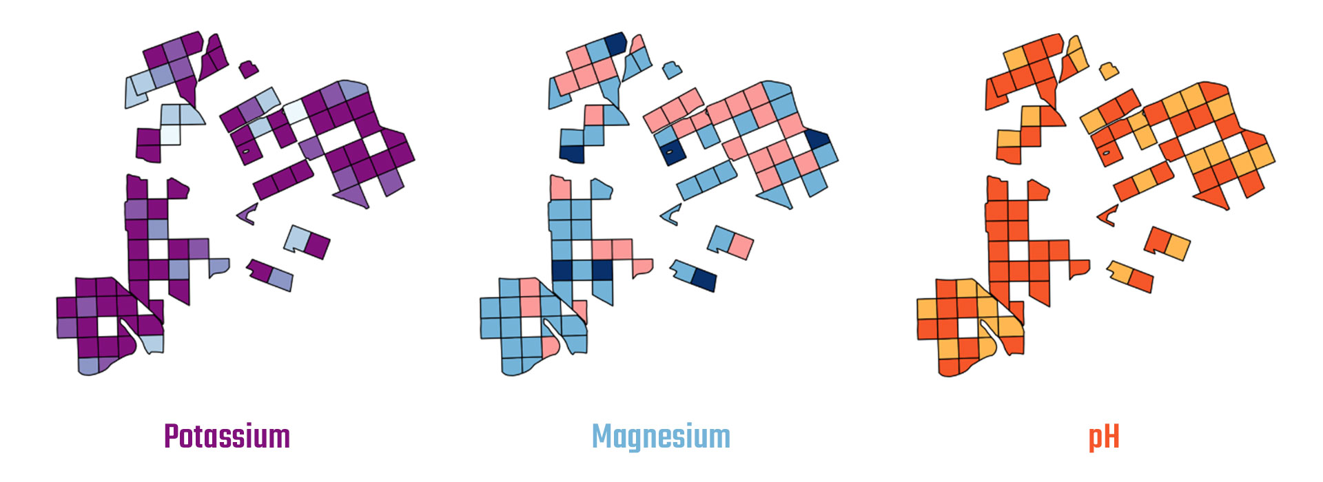
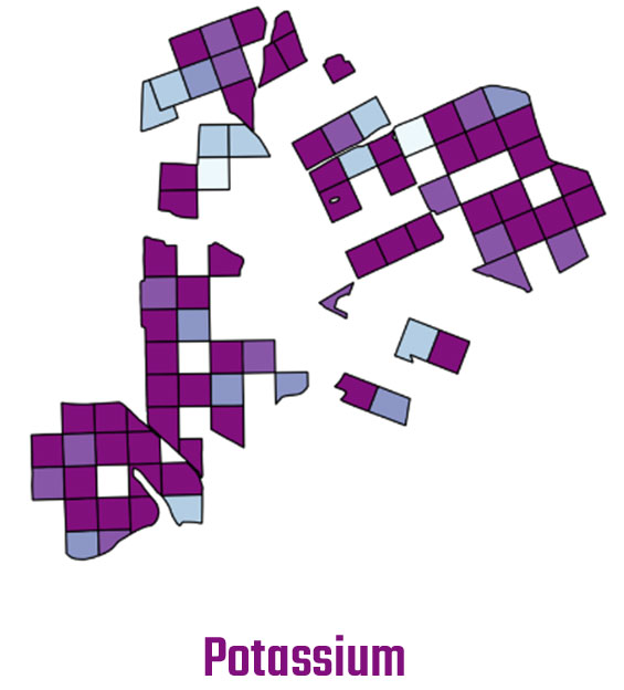
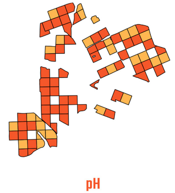
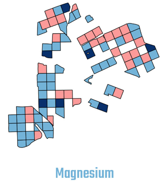
SoilEO is a remote and high-resolution mapping service of your field in the context of soil nutrients: magnesium (Mg), potassium (K2O), phosphorus (P2O5) and pH.

However, instead of analysing your soil samples in a laboratory, it consumes airborne and satellite data to generate the same piece of information, thus – no labour work is needed nor extracting soil samples in a low-resolution manner.

Know your soil and make better decisions on fertilizing.

Why?

We know that new technologies can reduce mineral fertilizers usage on your field to protect the soil and environment. And… yes, generate some savings too.
By applying modern algorithms and analysing airborne or satellite specialized hyperspectral images of your field. From that, we extract information about macroelements levels in your soil. Yes, we know it sounds like science-fiction, but it actually works.
You will get a map of your field with the information about macroelements levels in it: magnesium (Mg), potassium (K2O), phosphorus (P2O5) and pH. Exactly the same map as if you would get from your soil sampling service and chemical analysis. But in our case – no laboratory nor soil sampling needed.

Benefits

Use less mineral fertilizers & protect your soil

With our high-resolution map, you will be able to optimize your mineral fertilize usage and dose it exactly where you need it. Apart from cutting cost, you will also protect your soil from overdosing fertilizers which has a huge negative effect in the long term.

Have your maps quicker

No need to wait weeks for the results from a chemical laboratory. With our satellite (or airborne) service your map is ready in days, not in weeks. This is crucial for winter crops.

Replace labour-intensive soil sampling process

With an automatic service like SoilEO, there’s no need to extract the physical samples of your soil. So, you’ll have less hassle and less human errors during the soil sampling process.

Here are a few example maps created using SOILEO

If you want to see full version of the maps below, including legend, please visit this page.

How it works? It's simple!

As you can see, only two steps require your input. The rest is handled by SOILEO!

01.

Order your map (you)

By selecting your field in an easy step like dropping a pin on a map.

02.

Acquire hyper-spectral images of your field (us)

We take care of acquiring hyper-spectral images of your field, depending on the clouds: it is either satellite image or airborne service.

03.

Analyse the data with SoilEO algorithm (us)

We run a series of sophisticated analytics with our own algorithms and models to generate valuable piece of information for you. We use AI techniques, thus it is fast as well as accurate.

04.

Generate your map (us)

A visual representation of macroelements content in your field as well as digital table-based form, so you can easily create a shapefile for your tractor and automate the fertilizing process.

05.

Optimize your fertilizing process (you)

With the knowledge about macroelements, adjust and plan fertilizing of your field for your next crop. And make it more cost-efficient with high-resolution maps.

Want to know more?

Drop us an email and we will reply within 24h!

Prefer to call us?

8.00 – 16.00 (GMT+2) during working days.

Are you an investor?

Check this page for more details.

Partners

Top Farms
świerkot

Mapped hectares

0 +
hectares mapped in 2019/2020 season
0 +
hectares mapped in 2020/2021 season